Whales counted from space by scientists using satellite imagery
Scientists from the U.K British Antarctic Survey (BAS), have been using the highest resolution satellite imagery to count whales from space!
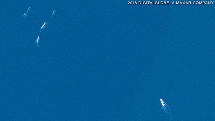
Advances in imagery resolution over the last decade has allowed scientists to conduct accurate counts of a range of baleen whales, even from 620 km altitude. Imagery is now sharp enough to capture distinctive shapes to allow identification of different species.
The team will conduct a first-of-a-kind audit of fin whales ( Balaenoptera physalus ) in the Mediterranean Sea. The assessment will be partly automated by employing a computer program to search through the satellite data . The Ligurian Sea is a 36,000 sq/km protected area for cetaceans and with the help of BAS, the regional authorities will gain knowledge and better understanding of the behaviour and movements of whales in relation to shipping to help avoid collisions.
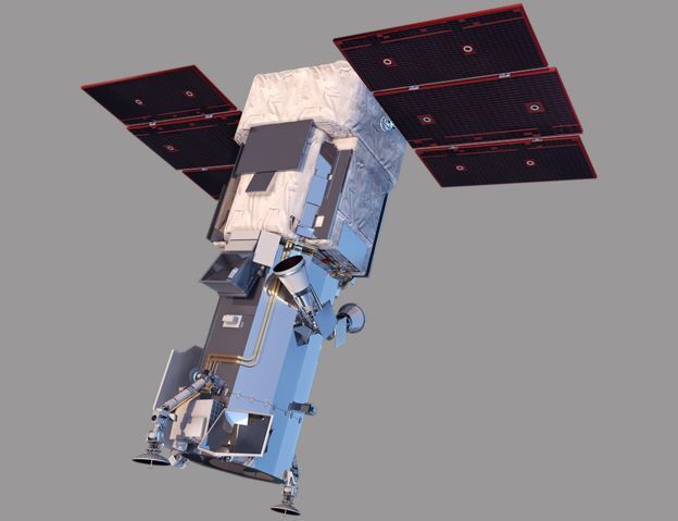
Previous studies have attempted to spot whales from orbit but had limited success. New methods from BAS include using imagery from WorldView-3 Spacecraft operated by American company DigitalGlobe which can determine the Earths surface at 31 cm. Only restricted military systems see in more detail.
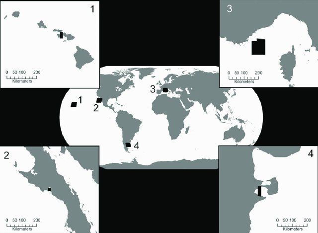
The BAS team, headed by Hannah Cubaynes, also affiliated with Cambridge University, examined WorldView-3 photos of filter feeding baleen whales in different parts of the globe; fin whales in the northern Mediterranean; humpback whales ( Megaptera novaeangliae ) off Hawaii; southern right whales ( Eubalaena australis) off the coast of Argentina and grey whales ( Eschrichtius robustus ) off the coast of Mexico.
Fin and grey whales were found to be the easiest species to identify from satellite imagery. In addition, typically surveys for cetaceans are conducted from land, boat or air, which are limited to localised areas, where as whales being highly mobile marine megafauna can range across hundreds of thousands of square km. Satellite imagery will also help to improve knowledge on species whose feeding grounds may be offshore, far from land. Without effective means to survey large areas and improve our ability to track animals we cannot determine the rate of population recovery of vulnerable species post whaling era.
"This is a game changer- to be able to survey for whales without limitations of high costs or difficulty in deploying boats or planes"- said Dr. Jennifer Jackson, BAS. "Whales are indicators of ecosystem health, so collecting data on them on a larger scale can aid in management strategies for improved marine conservation".
BAS has already pioneered using satellite imagery to monitor smaller species such as penguins and albatross. However, there are stark contrasts in monitoring the different taxa, which include; in the case of penguins; individual birds are not counted, rather it is the general size of the colony that is measured and in the case of Albatross; scientists know where exactly to focus survey effort because the birds breeding sites that are restricted to a handful of locations. Spacecrafts will gather imagery of huge areas as they pass over the ocean! In addition to counts, size estimates and body condition of the animals can be examined. For example, in a 31-cm resolution image, a grey whale will take up 10 pixels.
Cubaynes and colleagues have published their research in the journal Marine Mammal Science. Link to paper here: https://onlinelibrary.wiley.com/doi/full/10.1111/mms.12544
© Ocean Research & Conservation Ireland (ORCireland) and www.orcireland.ie , est. 2017. Unauthorized use and/or duplication of this material without express and written permission from this site’s author and/or owner is strictly prohibited. Excerpts and links may be used, provided that full and clear credit is given to Ocean Research & Conservation Ireland and www.orcireland.ie with appropriate and specific direction to the original content.
SHARE THIS ARTICLE
